
Satellite imagery approved for agricultural monitoring in Northern Cyprus
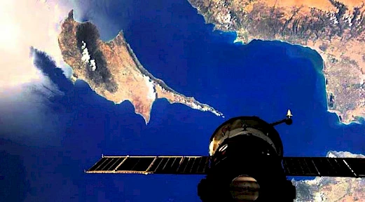
The authorities of the Turkish Republic of Northern Cyprus have decided to use satellite technologies for more effective monitoring of crop production.
The decision was made based on a proposal from the Board of the Common Agricultural Insurance Fund and is aimed at monitoring agricultural lands across the country. The main goal is to achieve a more accurate accounting of cultivated areas, early risk detection, and increased efficiency of agricultural oversight.
According to the document, in 2026, satellite images will be purchased and ortho-corrected at a cost of USD 63,789.
Ortho-correction will align the images with the actual terrain, ensuring accurate analysis of agricultural lands.
If necessary, additional services for image classification to assess drought impact may also be procured. Up to USD 15,464 may be allocated for this purpose.
These data will be used for damage assessment, risk analysis, and within the framework of the agricultural insurance system.
The purchase of satellite images and related services will be carried out through Türksat A.Ş., as the sole provider with the required technical infrastructure. The decision is made under the Public Procurement Law.
Authorities note that implementing satellite monitoring will allow more precise tracking of agricultural land conditions, timely detection of drought and crop losses, and improve transparency and efficiency of agricultural policy in Northern Cyprus.
Author

I am originally from St. Petersburg — a city with a unique character and rhythm. My professional life began rapidly: at just 16, I plunged into the world of global events. The World Cup, the roar of Formula 1 cars in Sochi, the energy of VK Fest, and the backstage of Fashion Week — I always…
You may also be interested in:
- Grape leaf harvest destroyed in the TRNC over banned pesticides
- Crystal-clear water and calm seas in Kyrenia: the perfect start to the holiday weekend.
- Electricity in Northern Cyprus to Rise by 22% Starting June 1
- Two Suspects Detained in Girne After Fake Driver’s License Scheme Exposed
- Turkey and the TRNC are preparing a gas pipeline: the project is planned to be completed by 2028
